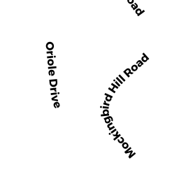
2 ORIOLE DR
Owner Information
FOX MEADOW REALTY CORP
129 SKYFIELDS DR
GROTON, MA 01450


Property Details
2 ORIOLE DR is classified as a Developable Residential Land (Vacant land).
2 ORIOLE DR is valued at 216300. The land is valued at 216300 and the structures are valued at 0.
This property is in Zone RA. Confirm with local Zoning Board authorities to ensure there are no overlays or other easements on this property.
The most recent deed for 2 ORIOLE DR is recorded at the local registrar in Book 28127, Page 084. 2 ORIOLE DR was last sold on 1998-01-30 for 1.
Assessment data from fiscal year 2021.
Flood Data
According to the FEMA National Flood Hazard Layer, this property does not appear to be in a flood zone. It may also be in an area not yet reviewed. Nonetheless, confirm this information prior to taking any action.
To view the flood hazards around this property, create a FEMA "Firmette" Map of the area around 2 ORIOLE DR.
Broadband Internet Providers
| Provider | Type | Bandwidth (mbps) | |
|---|---|---|---|
| HughesNet | Satellite | 25 | 3 |
| Viasat Inc | Satellite | 100 | 3 |
| Verizon New England Inc. | Fiber | 940 | 880 |
| VSAT Systems, LLC. | Satellite | 2 | 1 |
| Charter Communications Inc | Cable | 940 | 35 |
| GCI Communication Corp. | Satellite | 0 | 0 |
Broadband service provider data from December 2020.
Adjacent Properties
- SANDY POND RD
Vacant, Conservation Organizations (Charitable Org.) owned by MASSACHUSETTS AUDUBON SOCIETY - ROBIN HILL RD
Vacant, Conservation Organizations (Charitable Org.) owned by MASSACHUSETTS AUDUBON SOCIETY - SANDY POND RD
Undevelopable Residential Land owned by FOX MEADOW REALTY CORP - 4 MOCKINGBIRD HILL RD
Single Family Residential owned by CARMENA, BRAD M. - 92 ROBIN HILL RD
Single Family Residential owned by VIJAYADHARAN, NURDAN - 2 MOCKINGBIRD HILL RD
Potentially Developable Residential Land owned by FOX MEADOW REALTY CORP - ROBIN HILL RD
Developable Residential Land owned by FOX MEADOW REALTY CORP - 84 ROBIN HILL RD
Single Family Residential owned by LUTTATI, JOHN M. - SANDY POND RD
Vacant, Utility Authority owned by TOWN OF GROTON, WATER DEPARTMENT